<?xml version="1.0" encoding="utf-8"?>
<?xml-stylesheet href="http://feelfine.blog.izumichan.com/rss/style.css" type="text/css"?>
<rdf:RDF xmlns="http://purl.org/rss/1.0/"
         xmlns:rdf="http://www.w3.org/1999/02/22-rdf-syntax-ns#"
         xmlns:content="http://purl.org/rss/1.0/modules/content/"
         xmlns:dc="http://purl.org/dc/elements/1.1/"
         xml:lang="ja">
<channel rdf:about="http://feelfine.blog.izumichan.com/rss/1.0.php?id=72886">
<title>Feel Fine!</title>
<link>http://feelfine.blog.izumichan.com/index.php</link>
<dc:date>2024-08-24T11:41:13+0900</dc:date>
<description>
Feel Fine! - RSS (RDF Site Summary).
</description>
<items>
<rdf:Seq>
<rdf:li rdf:resource="http://feelfine.blog.izumichan.com/article.php?id=72886" />
</rdf:Seq>
</items>
</channel>
<item>
<title>会津坂下駅から徒歩3.9kmを1時間かけてたどり着きました、福島県会津坂下町大字大上村字旱泥甲（ひどろこう）</title>
<link>http://feelfine.blog.izumichan.com/article.php?id=72886</link>
<dc:date>2024-08-24T11:41:13+0900</dc:date>
<description>


一段高い地ですが周囲の字は上谷地で湿地、泥が干上がった土地ゆえに字名なのでしょうか。地名表記探しましたが、公民館や消防団にもなく、ゆいいつ郵便受けのシールのみ。こちら 笹原宏之先生の97年論文で...</description>
<content:encoded>
<![CDATA[
<p>
<a href="http://feelfine.blog.izumichan.com/resources/72000/72886.jpg" target="_blank">
<img src="http://feelfine.blog.izumichan.com/resources/72000/72886-s.jpg" width="232" height="131" alt="72886.jpg" />
</a>
<a href="http://feelfine.blog.izumichan.com/resources/72000/72886-1.jpg" target="_blank">
<img src="http://feelfine.blog.izumichan.com/resources/72000/72886-1-s.jpg" width="112" height="243" alt="72886-1.jpg" />
</a>
<a href="http://feelfine.blog.izumichan.com/resources/72000/72886-2.jpg" target="_blank">
<img src="http://feelfine.blog.izumichan.com/resources/72000/72886-2-s.jpg" width="232" height="131" alt="72886-2.jpg" />
</a>
<a href="http://feelfine.blog.izumichan.com/resources/72000/72886-3.jpg" target="_blank">
<img src="http://feelfine.blog.izumichan.com/resources/72000/72886-3-s.jpg" width="232" height="131" alt="72886-3.jpg" />
</a>
<a href="http://feelfine.blog.izumichan.com/resources/72000/72886-4.jpg" target="_blank">
<img src="http://feelfine.blog.izumichan.com/resources/72000/72886-4-s.jpg" width="216" height="162" alt="72886-4.jpg" />
</a>
<a href="http://feelfine.blog.izumichan.com/resources/72000/72886-5.jpg" target="_blank">
<img src="http://feelfine.blog.izumichan.com/resources/72000/72886-5-s.jpg" width="160" height="213" alt="72886-5.jpg" />
</a>
<a href="http://feelfine.blog.izumichan.com/resources/72000/72886-6.jpg" target="_blank">
<img src="http://feelfine.blog.izumichan.com/resources/72000/72886-6-s.jpg" width="264" height="53" alt="72886-6.jpg" />
</a>
</p>
<p>
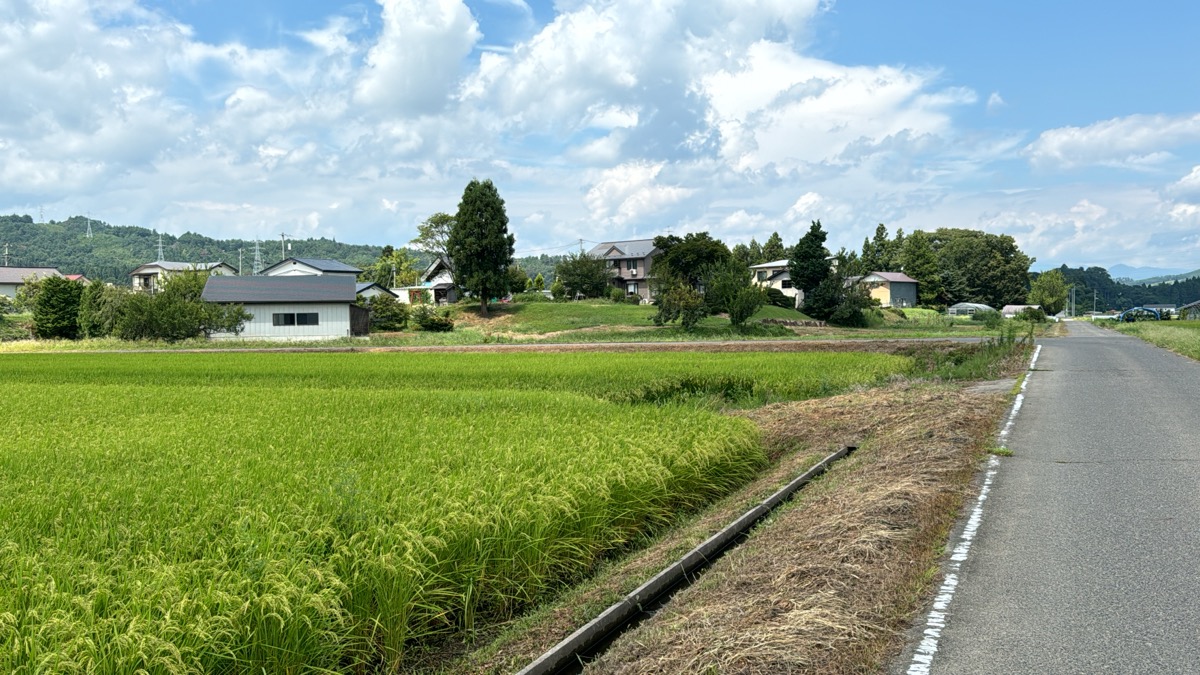
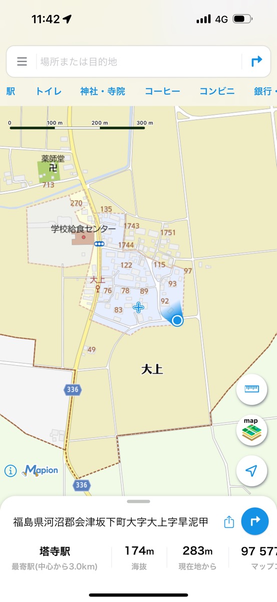
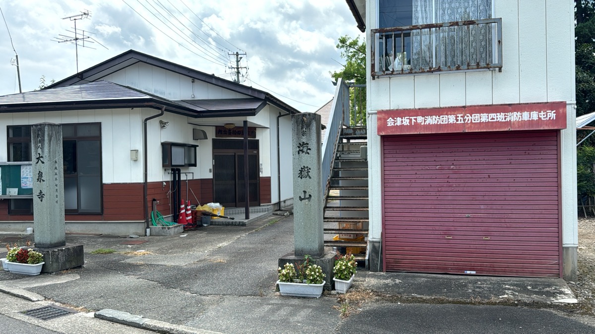
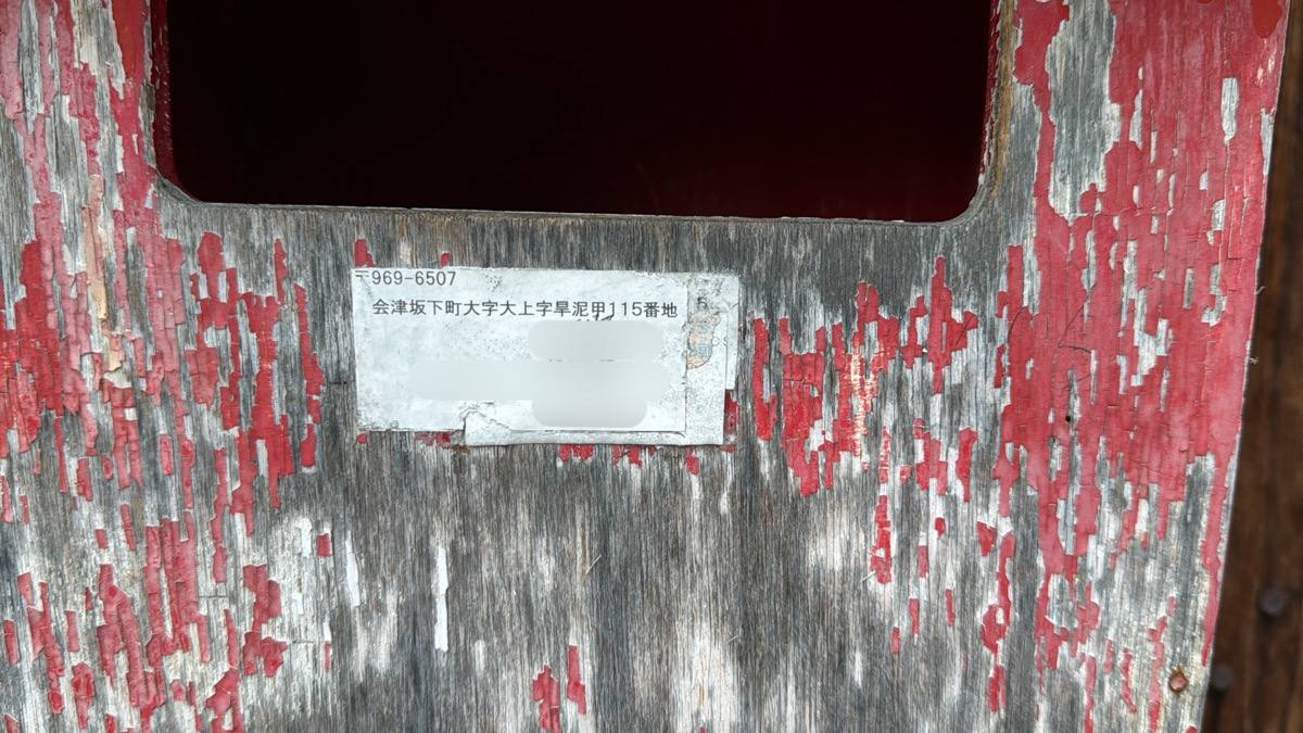
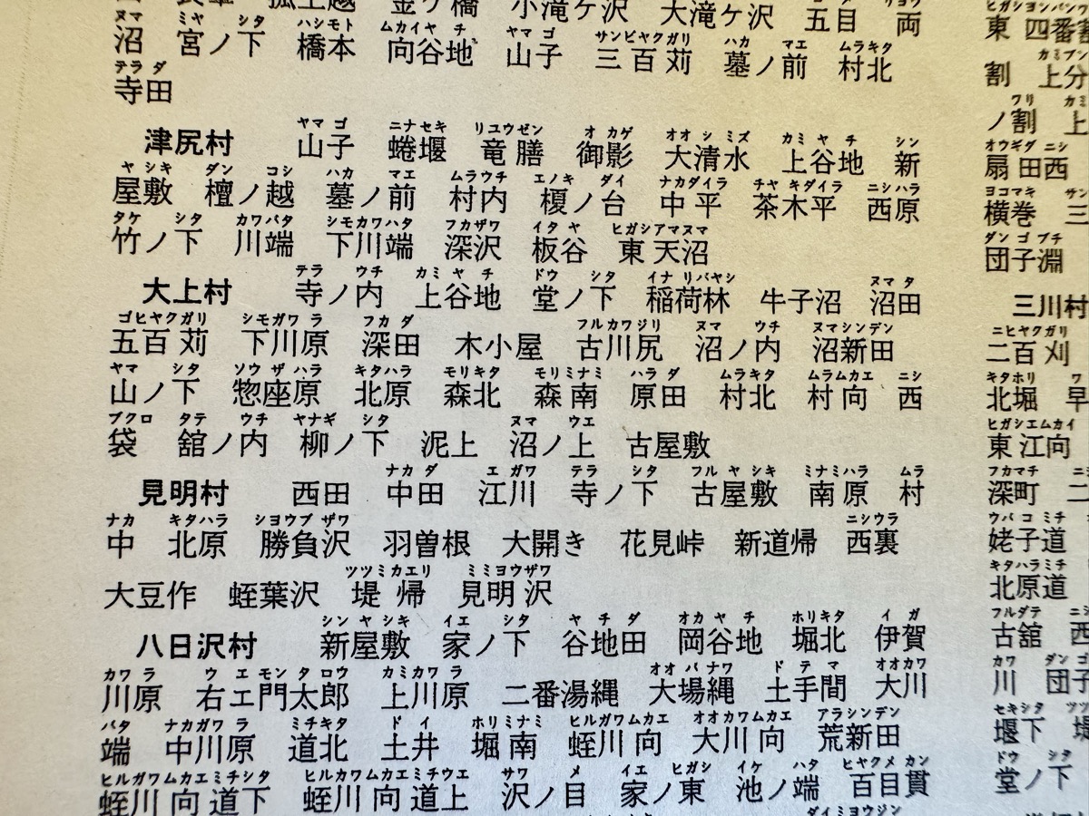
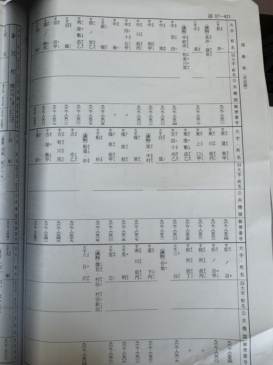
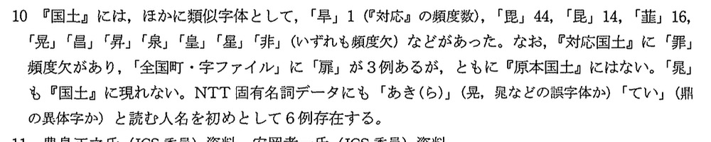
一段高い地ですが周囲の字は上谷地で湿地、泥が干上がった土地ゆえに字名なのでしょうか。地名表記探しましたが、公民館や消防団にもなく、ゆいいつ郵便受けのシールのみ。こちら 笹原宏之先生の97年論文で、ガチ幽霊文字「暃」の誤写元候補の1つとして挙げられた文字「旱」を含むということで来てみましたが、実は角川地名辞典の旧自然村大上村のところにも、国土行政区画総覧にも、出てない！ という壮絶謎状態です。なぜなんだ！？！？</p>

]]>
</content:encoded>
</item>

</rdf:RDF>